Today in this ManishTechniz blog, we are going to give information about GPS, in which we will know what is GPS, what is GPS full form, how GPS works, uses of GPS, the history of GPS, and the advantages and disadvantages of GPS. To get more information about GPS, definitely read this post to the end. So let’s know first of all that what is GPS.
At present, there has been a lot of change in technology. One of these techniques is GPS. Often, you must have heard the name GPS or used your mobile GPS location sometimes. Sometimes an app asks for location permission and then you have to turn on the GPS. So do you know what is GPS and how to get it? Today in this post, we are going to talk about GPS in detail.
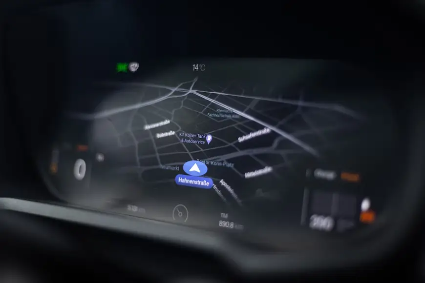
In the present time, if we want to reach a person, then we can reach by tracing his location or if we want to go anywhere and do not know the way, then we can go easily through GPS location. Now a days, GPS systems are being used in cars, trains, aeroplanes, buses and also in all industries, due to which the exact location of any device is known in fixed time.
What is the full form of GPS
The full form of GPS or the meaning of GPS is Global Positioning System, which is called “GPS” in short form. It is a global navigation satellite system used to locate the position of any object or place.
What is GPS System
GPS is a radio navigation system for navigation and operation by GPS satellites. It is based on the use of satellites in Earth’s orbit, which transmit information and also serve to measure the distance between the satellites and the user. When it is used to know the location of a technical device or a person technically, the help of GPS is taken.
GPS system operates from about 24 different satellites and it works to tell the location 24×7. At present, GPS receivers are being used in many ways, such as automobiles, smartphones, the health sector, GIM and smart watches, etc.
In the 1960s, the first GPS was developed by the US Department of Defence. At first, it was used mainly for US soldiers and military vehicles. At that time, the GPS system could not be used by ordinary citizens, but after few decades, GPS was freely used by ordinary citizens.
GPS is used to determine the distance, time, and speed of precise geographical locations irrespective of weather conditions on land, sea and air in the present.
It is being used on a large scale, such as for tracking vehicles in detail and is used by airlines, shipping firms, courier companies, drivers to follow the best route from one place to another etc.
Segments of GPS
There are three segments of GPS, which is also called Three-block Configuration of GPS. Which are as follows:
1. Satellite Segment (Space)
2. Ground Stations Segment (Control)
3. Receiver Segment (User)
1. Satellite Segment (Space)
In this, satellites work like those stars in the sky that were used in ancient times to know the location. They transmit signals to the planet from space, which GPS receivers pick up.
Six orbits with a height of around 24,000 km are used to disperse the receive satellites across the planet. There are 4 satellites in each orbit. There are 12 hours between each of these satellites’ orbits of the earth.
2. Ground Stations Segment (Control)
Using ground stations radar, they confirm the location of these satellites where they should be. Also, they are able to identify any faults occurring in these satellites. The primary responsibilities of ground stations are to control, maintain, and monitor the satellite.
3. Receiver Segment (User)
Here, satellite signals are received by receivers, which use distance calculations to determine the satellites’ location on the planet.
Types of GPS
GPS has a wide variety of applications. While developing different types of GPS, many modifications have also been made to it. While all GPS systems operate using the same fundamental principles, each class is specialised to meet specific demands. Types of GPS are following as:
1. Assisted (A-GPS)
2. Simultaneous (S-GPS)
3. Differential (D-GPS)
4. Non-differential
5. Mapping
6. Non-mapping
1. Assisted GPS
It commonly used because satellite signals are hard to catch due to trees or high buildings.
A wireless connection is necessary for Helped GPS to work. Devices usually use supported GPS, which allows you to fetch device location data in an emergency at any time.
2. Simultaneous (S-GPS)
A modification of GPS is called simultaneous GPS. That is help to send both voice data and GPS signaling from a mobile device.
This is especially useful in an emergency to allow service providers such as ambulances, fire stations, etc. to trace the source of a phone call even when the phone call is in progress.
3. Differential (D-GPS)
Differential GPS is a correction method that helps increase the accuracy of received data from receivers.
D-GPS is an enhancement technology for GPS that provides a better understanding of the actual location of an object or person.
4. Non-differential
Non-differential GPS, as opposed to D-GPS, uses direct satellite signals to narrow down the position. It is less accurate than D-GPS, but has a wider range of uses.
5. Mapping GPS
It is a GPS unit that comes with in-built maps. Besides this, maps may be downloaded and added to Mapping GPS. Most frequently, mapping GPS is found in smartphones.
6. Non-mapping GPS
Non-mapping GPS is a GPS unit that doesn’t come with in-built maps. It shows your location and directions to go to another point without looking at the streets or landmarks on the device.
Types of GPS Tracking
1. Data Pushers
2. Data Pullers
3. Data Loggers
1. Data Pushers GPS Tracking
They are used to track any kind of vehicle, resource, or personal tracking. The position of any personal vehicle or resource is communicated to the server in this sort of tracking at regular times, where the data is saved and analysed to identify.
As far as tracking the vehicle is concerned, the GPS tracking unit not only tells the position of the vehicle but also analyses the speed at which the vehicle is moving.
These units send all the necessary information to the server, where all the necessary coordinates are analysed and stored in the device. Anybody wants to utilise them can do so.
They are used by security agencies to keep an eye on suspects and by parents to find out the position and activities of their children.
2. Data Pullers GPS Tracking
Like data pushers, data pullers have the responsibility of tracking location. Even so, unlike data pushers, they ask to transmit the required data rather than sending it automatically to the server. Also, whereas information pullers are active and may be used to get data at any time, data pushers only send data at some intervals.
3. Data Loggers GPS Tracking
They are used to save any vehicle or person’s position in the device’s internal memory.
Thus, GPS tracking units of all three types are very beneficial and helpful for tracking the exact location of any specified vehicle or person.
How GPS works
Satellites are used to operate the GPS system. In space, there are 24 satellites and some additional satellites are present in orbit at an altitude of about 12,000 miles above the Earth’s surface. All these satellites revolve around the earth in twelve hours (two orbits per day), their speed is very fast.
These satellites are placed in orbit in such a way that the 4 satellite horizons can completely cover the earth from any point on the earth.
There are at least 4 GPS satellites in the line of sight of the receiver on Earth. The transmitter GPS sends information about position and time to the receiver GPS at a fixed interval.
Signals are radio waves that are transmitted to a receiver device. The distance between the GPS receiver and the satellite is calculated by finding the difference in time between the signal sent from the GPS satellite and the time it is received by the GPS.
To know the position of a 2D GPS, at least 3 satellites are required which include latitude and longitude. At least 4 satellites are required for a 3D position. In this case, latitude, longitude, and altitude are included.
For example- as soon as you turn on the GPS location on your smartphone, the phone acts like a receiver and connects to whatever satellite is present near the location. It connects to about 4 satellites at a time and navigates to the correct location. Similarly, other devices also have a GPS system, which works like a receiver.
History of GPS
Overcoming the limitations of the old navigation system, the US introduced the GPS system in 1973, for which the research of various engineers from the 1960s was included. For its use, the US Department of Defence used 24 satellites, initially the United States Developed for use by the US military, it became fully public in 1995 but was given to the civilian population in the 1980s.
The credit for the construction of the GPS system goes to Roger L. Easton of the Naval Research Laboratory, Ivan A. Gatting and Bradford Parkinson of the Applied Physics Laboratory, as well as Gladys West, are credited for the development of communication technology. This was an incredible change, without communication, GPS would have no value, so its contribution is unique. Used to be.
The design of GPS is based on the LORAN and Dikka Navigator systems, which began to be developed in the 1940s. An artificial satellite is only helpful for GPS. In such a situation, the time in the satellite runs 38 microseconds fast, so that it can tell the correct location in exact time. GPS runs from the satellite and for this, till now, various types of satellites have been sent into space, which are continuously operational 24×7 is working.
Uses of GPS
At present, there is a lot of use of GPS. It is being used in almost all different areas but there are five major categories under GPS use – location, navigation, tracking, mapping and time.
Below are some of the GPS applications where it is used
- The GPS system is used to find out the location of any device, due to which the location of any device is easily known.
- It makes the navigation system very easy as you are always informed about the right turns and routes to reach the destination, thereby reducing the navigation time.
- The GPS system can be installed to monitor any object, car, bus or personal item. It can easily track all these things.
- Several nations use the GPS system as a defence tool while at war. All nations utilise it in their military activities and military equipment.
- The GPS receivers provide real-time position information to the pilots of the aircraft. It also provides maps to different destinations depending on the operating status of the aircraft.
- The GPS navigation is used for emergency response. In the case of a disaster or flood, the GPS system is used by the rescue team for relief work.
- The GPS is also used for entertainment, like when it is used to play games like Pokemon Go and Geocaching etc.
- Apart from the health sector, agriculture, military, mobile communication, security, travelling, social activity, drones and other devices.
Advantages of GPS
- The GPS gives the user location based information in real time. It helps with navigation, weather forecasts, and sports.
- The GPS signal is powered by satellites all over the world and is worldwide. So it can be accessed anywhere.
- The weather does not hinder the functionality of GPS as it works well in any climate, unlike other navigation devices.
- If you visit a new place, it helps you find nearby restaurants, hotels, shopping malls, petrol pumps etc.
- It indicates the direction of each turn on the route to the destination so that you can get there without difficulty.
- The cost of GPS is very low as compared to other navigation systems. Due to its low cost, it can be applied to other technologies like mobile phones, which is an important feature.
- The United States periodically updates the GPS system. So it is more advanced.
Disadvantages of GPS
- Several factors might cause GPS to break occasionally. Thus, we need backup maps and directions.
- The battery runs out in 8 to 12 hours since the GPS chip uses more power. Regular battery replacement or recharging is required for this.
- The GPS signals may not provide precise signals if there are barriers like trees, buildings, floods, or extreme air conditions including climate-related risks like geomagnetic storms.
- Large constructions or solid walls can’t block the GPS signal. The user cannot use it indoors, under water, in dense tree areas and underground places etc.
Who invented GPS?
The GPS system was invented by some people. Those names are Ivan Getting, Bradford Parkinson, and Dr. Gladys West Roger L. Easton
During which year the project on GPS system was started?
The GPS system project was initiated by the US Department of Defense during the year 1978.
What is present in the satellites of GPS that provide accurate time information?
Atomic clocks are present in GPS satellites which provide accurate time information.
What Kind of Signals Do GPS Satellites Generate?
GPS satellites generate radio waves signals.
What services are provided by GPS?
Positioning, Navigation and Timing services are provided by GPS.
Which mathematical principle is involved in GPS?
The GPS system uses a technique called trilateration.
What is the full form of GPS?
GPS stands for Global Positioning System
What is the use of GPS?
Major users of this device are: smartphone users, home delivery companies, transport companies, scientists, surveyors, pilots, boat captains, workers in mining and agriculture are some of the people who use GPS on a daily basis for work.
Which device is the GPS?
GPS is an output device